No Soggy Gear: Rain won't ruin Bucket List Hike or Overlanding Expo with Charlotte's Webbing
Outdoor Element
In July and August, Charlotte's Webbing saved our bacon! Well, maybe not actual bacon, but it did save gear from being drenched in a couple of downpours.
Most recently, Mike (OE Founder & CEO) and Joe (OE Partner) attended an Overlanding Expo in August. The expo was held outdoors in beautiful Colorado over a few days time. Overlanding enthusiasts camp out all around the exhibitors.

As exhibitors, Mike & Joe set up the OE booth. Picture a canopy with a couple of tables and product display backdrop. Strung to display gear is Charlotte's Webbing.

Not long into the expo, it began to rain. And rain. And rain. After seeing how our gear was protected from the rain, overlanders from all over the expo were rushing over to purchase Charlotte's Webbing so they too could keep their gear dry in their campsites. Word spread quickly and Charlotte's Webbing - the solution to keeping gear off the ground and dry - was a hit!
Earlier this summer, at the end of July, Joe, his wife and their son Shem completed the epic hike of Maroon Bells Four Pass Loop.

This hike is remote. Camping is primitive. There are no tables to set gear on or vehicles nearby to put gear in to protect it from rainfall.
But Joe and Shem, being Eagle Scouts and wise backpackers, came prepared with Charlotte's Webbing. They strung it between trees, hung their gear up using gearbiners and clips, then covered the line with a secured tarp before going to bed. Voila! Elevated, dry gear no matter what Mother Nature threw at them. Good thing because it didn't take long for rain to come while they were in their lightweight three-man tent (thanks Scott at Near Zero for some awesome gear).

No way three packs could have joined them in there. And it didn't need to because it was all safe and dry on the line using Charlotte's Webbing. Tada! Crisis averted!
Rain couldn't ruin Joe's bucket list hike or the awesome overlanding expo. Goes to show that OE gear really is designed to help you Explore with Confidence!
Read Joe's full experience and see pics of his trip below - including his insider tips on how to get the most out of a hike of Maroon Bells. Enjoy!
Maroon Bells Four Pass Loop July 2023
by Joe Brown, OE Partner
This year is turning out to be a good bucket list year. My wife and I secured last-minute permits in March and hiked down to Havasupai Falls, got evacuated due to flood waters (read earlier blog) and had an awesome time. We booked a Machu Picchu trip for next year. And, just a few months ago we hiked Maroon Bells Four Pass Loop.
Here is a rundown of our journey with some tips for those interested in experiencing the Maroon Bells Four Pass Loop.
I got on Recreation.gov right at 8:00 am on Feb 15 to secure permits for the exact weekend I wanted at end of July. Print out your permit and bring a copy with you. I intended to park at the trail head, but failed to secure parking permits in advance, which turned out to be a good thing. We ended up parking at Buttermilk for just $6/day (beats $40/day at Aspen Highland). We then took a couple free, short bus rides to Aspen Highland and hopped on the shuttle ($16 pp r/t) to/from the trailhead. We drove up the day prior and stayed at the Basalt Mountain Inn – a great little motel about 20 minutes out of Aspen. It was clean, friendly, quiet, updated rooms, comfortable beds, tasty breakfast, no frills. I certainly recommend them for a convenient stay prior.
After eating breakfast right when they opened, we headed into town to park at Buttermilk, hop on the busses and made our 8:45 am shuttle loading time. Shuttle ride was about 20 minutes and had an interesting narration on the way up. We started on the trail around 9:15 am. Great views of the Maroon Bells from Maroon Lake. The nice, comfortable gravel path took us along the lake then the “real” trail started. First stop in less than a mile was Crater Lake – a small, quaint lake great for a rest and some pictures. There were a lot of people from Maroon to Crater Lakes. At Crater Lake, we went left to do the loop clockwise (for the great views of Snowmass Lake and to save Buckskin Pass for the last day when our packs were lighter).


We headed toward West Maroon Pass, passing a bunch of day-hikers coming from Crested Butte going to Aspen. We chatted with a ranger who asked to see our permit. Oops. I wrote down the number, but forgot to print it out like I should. Luckily I had a picture of it on my phone. We got a little rain along the way, enough to don our ponchos. As we were nearing the pass, I thought we had risen above tree line but then came to a clump of trees off to the left with some foot paths headed to them. We had heard this was a great place to camp. It was amazing – enough trees for shade and our hammock, on a little cliff area overlooking the valley back the way we came, and level tent spots. It really was magical. There was enough room for maybe 3 campsites, but we had the place to ourselves. This was probably about 1 mile from West Maroon Pass. We ended up seeing 4 deer here, one of which came within 15 yards of our campsite. Our son slept in the hammock with a couple tarps over him due to rain, but he had the absolute best view.


The next morning we passed another clump of trees with foot paths just a little past our camp area, but I think our campsite with the valley view was a little better. Just past here the ascent started we were fully above tree line. After about a mile of steep ascent we reached West Maroon Pass. I had read that it was worth a scramble up the rock to see down into Crested Butte, but can’t really say it was worth the effort. From West Maroon to Frigid Air Pass it is about 2.4 miles and the wildflowers almost the whole way were amazing. We absolutely loved this section.

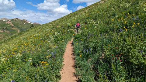
There was a steep, arduous climb up to Frigid Air Pass. At the base of the climb we saw a couple backpacks that someone ditched on the side of the trail. As we neared the top, we came across a young man, a woman (guessing it was mom) and an elderly lady (guessing grandma) heading down from the pass and they claimed the backpacks. I mention this because this climb up was no cake walk and this elderly lady must have been in her upper 70s at least, and somewhat frail. I have no idea how she made it up that trail. Crazy.

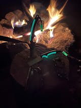
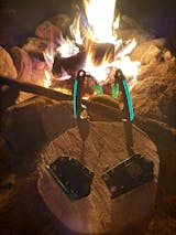
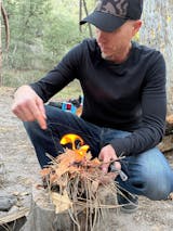
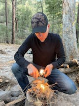
The other side of Frigid Air also had wonderful wildflowers, especially columbines. We hiked another 4 miles down to and in the Fravert Basin, on the watch for the waterfall we heard about. We came upon some water trickling down the side of the mountain and wondered if that was the waterfall. Alas, it was not. The real waterfall was a little further down on the right side of the trail just as the trail started down with switchbacks. We ended up hiking a little further to try to get away from the bugs. After passing a bunch of campsites and a stream crossing that required us to take off our hiking shoes (I had water socks), we found a great campsite to the right, in the trees. We didn’t have quite the view as the night before, but we were able to make a really nice campfire despite the wood being a little wet (the bellows in the Omni-Tensil really came in handy here). This site was great – plenty of room, fairly level ground, no other campers in sight, lots of big trees. Bugs weren’t too bad here either. This campsite turned out to be maybe a few hundred yards before the first turnoff to Geneva Lake. We thought about going to the lake, but were out of steam and stayed here in North Fork.

(here Charlotte's Webbing is in the back of our site holding up our gear)

Day 3 was going to be our shortest day but given the elevation gain up Trail Rider Pass and the rock slide climbs down to Snowmass Lake we didn’t want to push it. The views of Snowmass as we hiked down were phenomenal. This was one of the reasons we chose clockwise. However, as we hiked down I failed to recognize the cairns at the rockfall and we ended up following a false trail for a little bit. This trail took us over some rock and then some snow-covered rock that was a little treacherous. As we got across the snow/rock, we realized there was no more trail. Going back over the snowy rock wasn’t really an option for my wife. I was all set to just start heading down toward the lake to find the trail once we got down there. Fortunately my wife suggested I put my pack down and do some reconnaissance. If there is one thing I have learned over the years is I need to do better at listening to a wise woman. So, I scrambled up the steep, slippery mountain and found the real trail just about 50 feet above us. After securing our poles to our packs, we crawled up the steep slope using all fours to reacquire the actual trail.
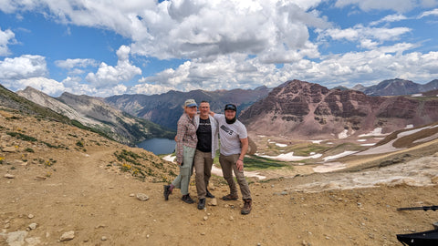

Our plan here was to camp at Snowmass Lake. We stopped and I stepped into the lake and didn’t see another soul except for my wife and son. Awesome. It was gorgeous and there were lots of open campsites. However, we were anxious to see our daughter who was returning from overseas the next day, so we continued on for a couple more miles and found another awesome campsite just before the switchbacks heading up to Buckskin Pass.


(here you can see Charlotte's Webbing in use at our site)
This campsite (actually two of them, one just past the other) was in a little nook/valley to the left of the trail as it started to ascend and as the trail bore a slight right. Here we made an almost ideal camp – tent on level ground, hammock close by, Charlotte’s Webbing close but off to the side a little. I claimed the hammock in advance – my son occupied it at the other campsites. The three of us ended up sleeping in the tent together.
Shortly after some relaxing and dinner it started to rain. Since we wanted to head out early the next morning, we were OK with retiring to bed early. Our packs were all hung up on the Charlotte’s Webbing with a tarp covering them and clips on the ends securing it in place. Good thing since it really came down. I love the sound of rain on the tent, especially when everything works as it is supposed to work and we, and our gear, stay nice and dry.
After a good night’s sleep, we rose early and decided to forgo a hot breakfast since we had plenty of energy bars and meat sticks left. We were on the trail before the sun came up over the mountains, but with plenty of light. The switchbacks up Buckskin seemed a little easier, mainly because of the interesting terrain. The trail led us through wooded area, various small brush areas, some decent wildflower areas and some streams. It was a gradual incline and very pretty. The views looking over both sides at the top of the pass were quite nice. Confession here – I misread the map and had us hike a little further up the pass than was needed, but my son soon enough corrected me and set us back on the right path down the switchbacks on the other side. We thought we would be able to do the hike down much faster than we did, but it turned out to be a more difficult trail than we expected – lots of rocks, roots and other obstacles with a pretty good rate of descent. It seemed to go on and on and on, partly because of our misperception and partly because we were anxious to see our daughter. We were still very much able to enjoy the beautiful scenery.


We got down to the trailhead at Maroon Lake before noon and hopped on the next shuttle that was conveniently there waiting. At Aspen Highland we got on the CM bus, off at 8th, crossed the street, got on the L Glenwood bus and off at the Buttermilk stop (both buses are free for local travel). The Buttermilk long-term parking lot has some EV chargers, but the other side of Buttermilk (very close) has Tesla superchargers. As we briefly added some juice, we changed from our stinky hiking clothes into some fresh clothes we had waiting for us in the car. We then headed out to Edwards to grab a snack while the car charged for the 2.5 hour ride home.
It was a wonderful trip. I was very surprised we didn’t see any more wildlife. We saw no elk or moose scat. We saw some bear scat and some other unidentified droppings. We saw dear, marmots, a blue grouse, pikas and squirrels, but not much more. The flowers and scenery were amazing though. Overall, we loved it!
Our packs (2 x 50L + 45L) weighed between 23 and 28 lbs, with water, at the start of the hike.
Notable Gear List (not clothing):
OE Field Feather Knife (prototype)
Hiking poles
Chairs
Hammock
Sawyer water filters (one Micro and one Mini)
Sawyer Bug/Tic sprays (Permethrin for gear, Deet for ourselves)
Ursack Major XL bear bag
Loksak Opsak bag
Map
Food was mainly from Mountain House & some from Backpacker’s Pantry. All quite good.

Get out and Explore with Confidence!


